
Illinois: A History in Pictures
By Gerald A. Danzer, 2011
Offering a rich and expansive history that extends far beyond the familiar anecdotes about Abraham Lincoln and the Great Chicago Fire, Illinois: A History in Pictures gathers drawings, engravings, photographs, maps, and other illustrations to inspire imaginations young and old to envision the history of Illinois in all its depth and breadth. Gerald A. Danzer distills the story of Illinois from these visual artifacts, exploring the state’s history from its earliest peoples and their encounters with European settlers, through territorial struggles and the strife of the Civil War, and into the modern era of industry and urbanization.
The Imperial Map: Cartography and the Mastery of Empire
Edited by James R. Akerman, 2008
Maps from virtually every culture and period—from Babylonian world maps to Saul Steinberg’s famous New Yorker cover illustration, “View of the World from 9th Avenue”—convey our tendency to see our communities as the center of the world (if not the universe) and, by implication, as superior to anything beyond these immediate boundaries. Mapping has long been a tool by which ruling bodies could claim their entitlement to lands and peoples. It is this aspect of cartography that James R. Akerman and a group of distinguished contributors address in The Imperial Map.
Critically reflecting on elements of mapping and imperialism from the late seventeenth century to the early twentieth century, the essays discuss the nature of the imperial map through a series of case studies of empires, from the Qing dynasty of China, to the Portuguese empire in South America, to American imperial pretensions in the Pacific Ocean, among others. Collectively, the essays reveal that the relationship between mapping and imperialism, as well as the practice of political and economic domination of weak polities by stronger ones, is a rich and complex historical theme that continues to resonate in our modern day.
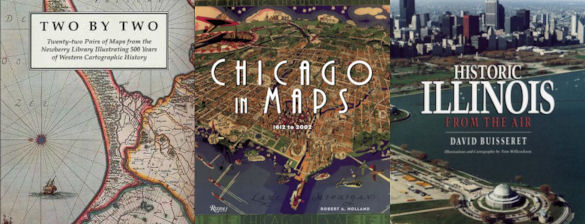
Chicago in Maps: 1612 to 2002
By Robert Holland, 2005
Chicago in Maps is a luxuriously illustrated cartographic history of Chicago, known for centuries as the gateway city to the West. The powerful and evocative documents reproduced here offer an unprecedented avenue to the city’s past-a fascinating collective portrait of the evolution of one of America’s great towns. Among the seventy-four maps featured, many are seminal exemplars of this timeless art form: the “Kinzie Map,” which accompanied the Narrative of the Massacre of 1812; the Rand McNally “View of the World’s Columbian Exposition” of 1893; Daniel Burnham’s influential “Chicago Plan” of 1909, which epitomized the ambitions of the City Beautiful Movement; W. T. Stead’s “Map of Sin”; and Bruce-Roberts’ 1931 “Gangland Map”-a tongue-in-cheek “exposé” of a city populated by such powerful underworld figures as Al Capone, “Baby Face” Nelson, “Machine Gun” Kelly, and others, indicating various gang territories and warehouses. Filled with fascinating historical anecdotes and detailed scholarship, Chicago in Maps is a work that will be highly prized by map lovers and history buffs alike. It is a sumptuous feast of glorious full-color reproductions of maps by the some of the world’s most extraordinary cartographers.
Historic Illinois from the Air
By David Buisseret, 1990
“A distinctive and skillful effort to bring facets of Illinois history to a popular as well as an academic audience.”—John Hoffman, Illinois Historical Survey, University of Illinois Library